What Do the Geographical Names of Szigliget and Its Surroundings Tell Us?
JÓZSEF SZÁSZI
Tóparti Secondary School and Arts Vocational School, Székesfehérvár; Ez az e-mail-cím a szpemrobotok elleni védelem alatt áll. Megtekintéséhez engedélyeznie kell a JavaScript használatát.
The section presenting the geographical names of Szigliget and its immediate surroundings was omitted — for reasons of content and length — from the article on Szigliget published in the Outlook column of issue 2/2022 of GeoMetodika (Szászi J. 2022). I also undertook to supply this missing part in order to draw colleagues' attention to the importance and usefulness of knowing geographical etymology (the origins of geographical names), and to illustrate the many ways in which the teaching of the physical and human geography of this microregion can be further enriched, both in and outside the classroom.
Before addressing the origins of the geographical names of Szigliget specifically, let us briefly clarify what geographical names actually are. The Hungarian Committee on Geographical Names bases its work on the following definition: "We call a geographical name any linguistic form used by smaller or larger communities to identify natural (mountain, stream, island, desert, etc.) or man-made (canal, road, field, settlement, etc.) features of the Earth's surface" (Fábián P. et al. 1998, p. 15.). Those with a deeper interest in the subject of geographical names are recommended to read Gábor Mikesy's study titled Wandering Among Geographical Names, published in issue 1/2022 of GeoMetodika.
In terms of its geographical location, Szigliget lies in one of the most beautiful microregions of the Northern Balaton mesoregion — part of the Transdanubian Central Mountains — at the meeting point of the Tapolca Basin (more precisely, a half-basin) and the trough of Lake Balaton. As a result of the centuries-long fluctuations in the water level of Lake Balaton, its territory was at times an island and at other times a peninsula surrounded by marshland.
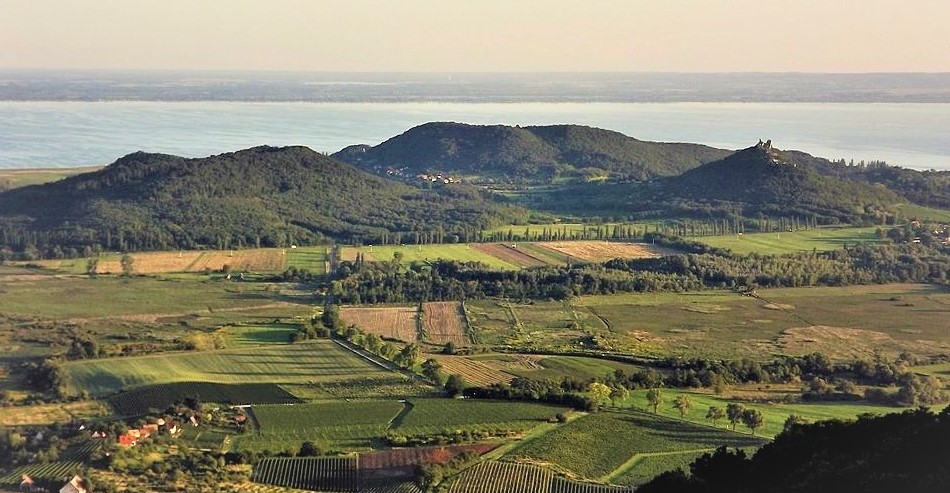
Following the Mongol invasion, the famous Szigliget Castle began to be built on the easily defensible Castle Hill (Vár-hegy). According to Kis L. (1983), the name Szigliget does not, however, derive from the word sziget (island), but from the prefix and suffix szig-, szeg-, szög-, which refer to a projection, indentation or peninsula (as in Szeged and Zalaegerszeg, or the "name-relative" Szögliget, above which the ruins of Szádvár Castle rise); combined with the word liget (grove, woodland), as in another "name-relative" settlement, Szegerdő. According to the same author, while the names of the surrounding inselbergs (Badacsony, Gulács, Csobánc and Tóti Hill) are mostly of Slavic origin, the name Szigliget was coined in Hungarian at the time of the Hungarian conquest. The neighbouring Szent György Hill (St George's Hill) is likewise Hungarian in name, but its name dates from the medieval period.
The name of the settlement that gave the Tapolca Basin its name is of Slavic origin. It derives from the word tyoplűj — meaning lukewarm-warm (water) — since the water of the karst springs rising from the karstic cave system beneath the town maintains a constant temperature of 18 degrees Celsius in both winter and summer. Mill Lake (Malom-tó) at the heart of Tapolca was formed by damming the water of these springs. Due to its relatively constant temperature, the lake does not freeze in winter. The water flowing out of the artificially dammed Mill Lake is carried by the now-regulated Tapolca Stream into Lake Balaton, where it flows into the lake beside Szigliget.
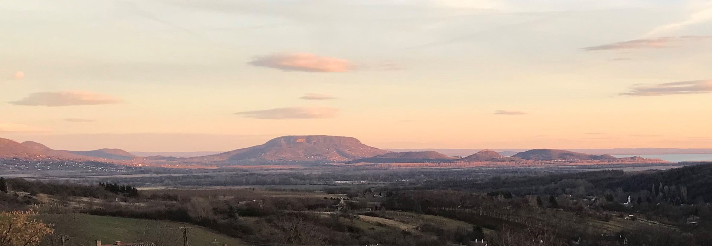
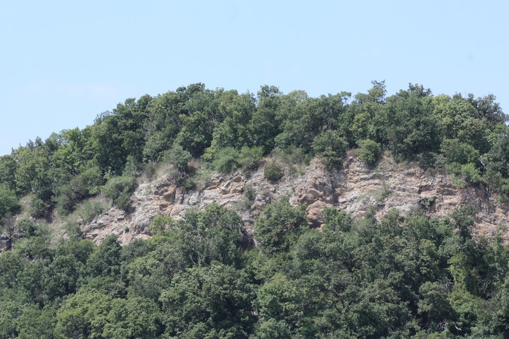
The etymological renown of Szigliget is further demonstrated by the fact that Lajos Kis's (1983) Etymological Dictionary of Geographical Names lists additional geographical names from Szigliget: Kamon-kő, Óvár, Rókarántó and Soponya (also known as Vilma Hill). The name Kamon-kő also confirms that the Hungarian conquerors settled in this area alongside a smaller Slavic ethnic group, since in Slavic languages kámeny means stone or rock. This is likely how this 243-metre-high hill (a volcanic inselberg) and its pyroclastic rock came to receive its dual name (Kis L. 1983, Szászi J. et al. 1992).
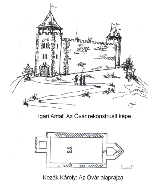
Óvár is a regular cone-shaped hill 180 metres high, a secondary volcanic inselberg (Szászi J. 2022). It takes its name from the ruins of a small fortress (castellum) preserved on its summit. The first exploratory excavation at Óvár was led in 1956 by archaeologist Károly Kozák, who drew the ground plan of the small fortress on that basis (Kozák K. 1960). As Károly Kozák told me personally, the excavation was interrupted due to the "events of 1956", so the origins of the fortress could not be determined at that time. The second, more significant excavation took place in 2003, led by archaeologist László Gere. The finds uncovered at that time date the construction of Óvár to the mid-15th century, most probably commissioned by Miklós Újlaky, as the financial and political position of the Újlaky family made the construction possible (Gere L. 2006).
The hill acquired its alternative name, Királyné szoknyája ("Queen's Skirt"), from the fact that its silhouette (especially from the south) resembles a crinoline skirt. This second name of the hill most likely arose from a literary source: Kálmán Mikszáth published his short story "Királyné szoknyája" in his collection A Jó palócok (Good Palóc Folk, 1882). It was presumably from this story that the name transferred to Szigliget (Kis L. 1983). The small fortress on the summit of Óvár is well worth a visit. The information board there presents the geological formation of this small hill, its flora and the construction history of the fortress (Gere L. et al. 2013), while the lookout offers a magnificent panorama: to the north-east rises Kamon-kő, and to the east and west lie the two neighbouring hills named Rókarántó and Soponya (Vilma Hill) respectively.
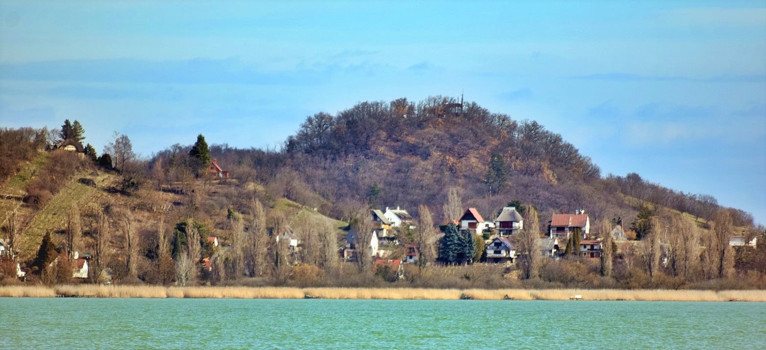
Rókarántó is a saddle-shaped hill 183 metres high; its name is formed from the combination of the word róka (fox) and the verb ránt (to pull, to attract). Its meaning is most likely "a place that attracts foxes" (Kis L. 1983).
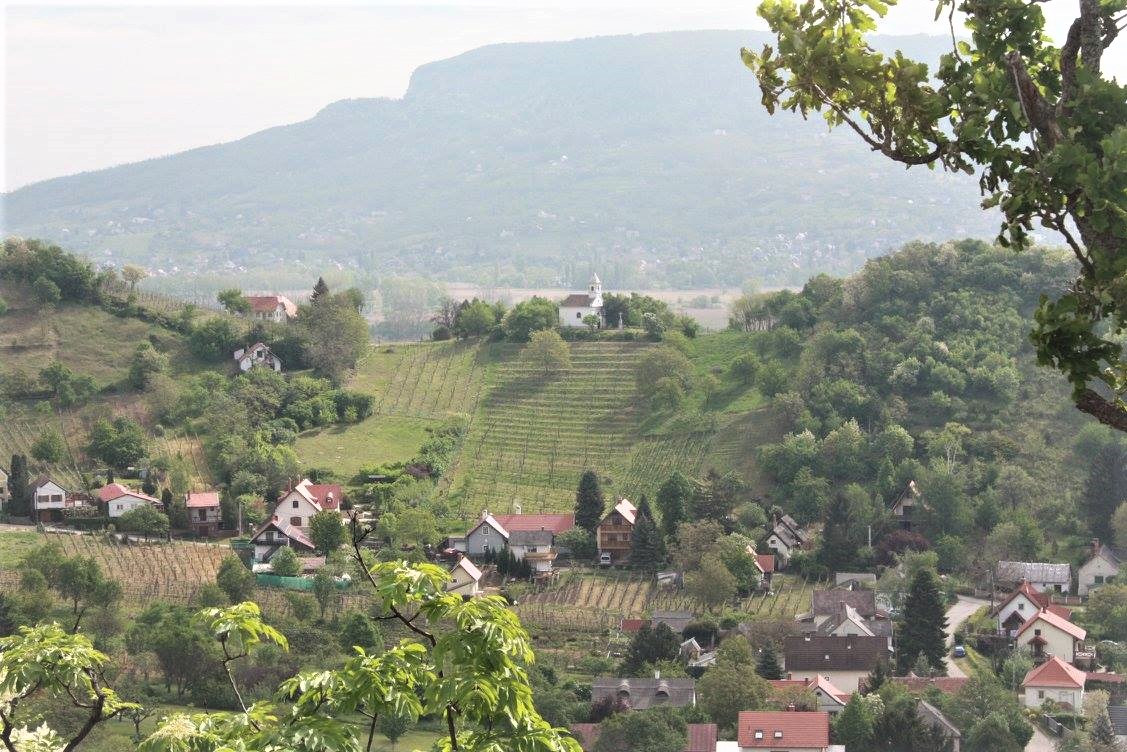
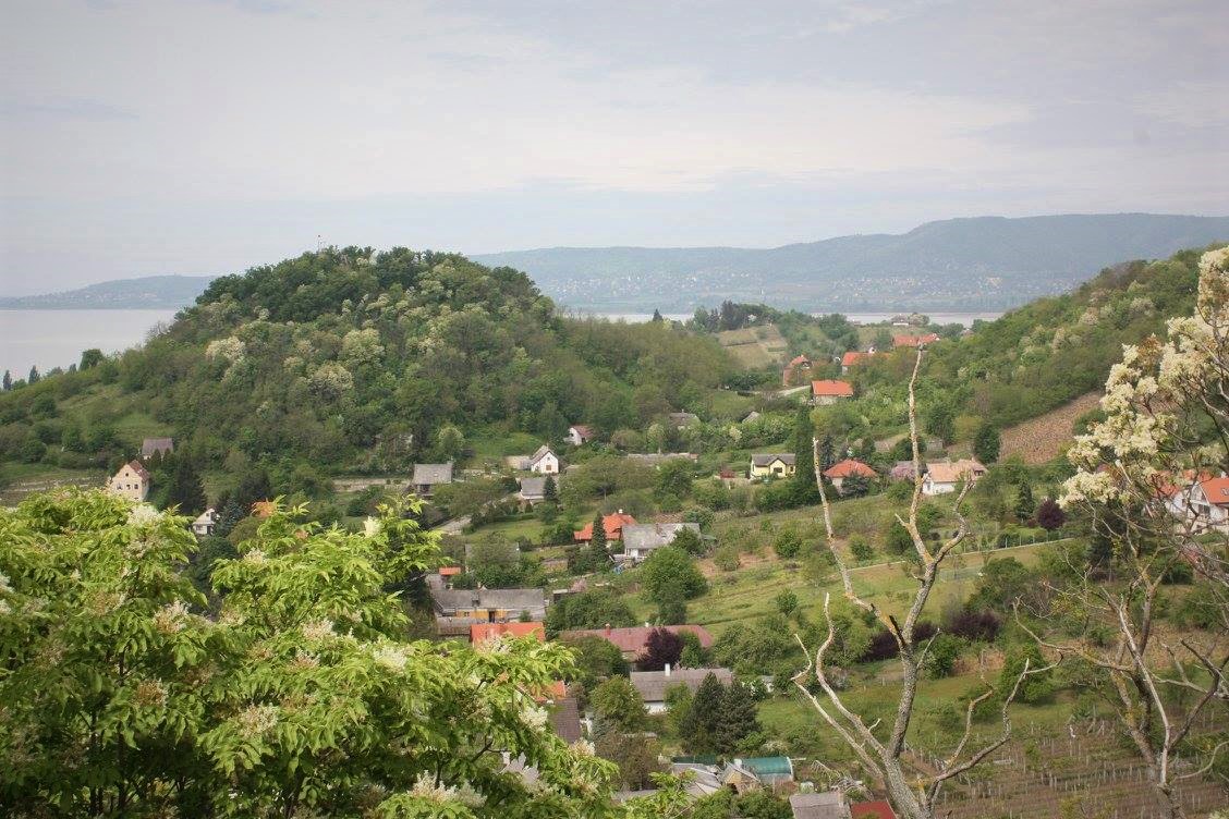
Soponya is likewise a saddle-shaped hill, 159 metres high. Its name is probably of Slavic origin (identical to the settlement of Soponya in Fejér County). Its meaning is uncertain; it may possibly derive from the personal names "Šoponja – Šeponja" (lame person) found in South Slavic languages. For the people of Szigliget, the Pannonian clay-sandy slopes of this hill, which produce fine wines, were of greater economic importance than the tuff summit itself; consequently, the name Soponya, as a field name, shifted to the eastern slope (Belső-Soponya, Inner Soponya) and western slope (Külső-Soponya, Outer Soponya) of the hill, while the tuff summit (pyroclastic peak) acquired the name Vilma Hill, most likely derived from a personal name (Kis L. 1983, Szászi J. 1997, 2022).
Further interesting geographical names can be encountered while exploring Szigliget, which were not included in the etymological dictionary mentioned above. For geographical and historical reasons, I would mention only the name Réhely, which, according to Kozák K. (1960), derives from the word révhely (landing place, ferry crossing). According to him, the Romans may already have used this small bay in Szigliget — lying between the Antal Hill tuff group and the Külső Hill tuff group — as a natural harbour. This is supported by the remains of Roman-era walls surviving in this area. Kozák K. (1960) was also the first to point out that the medieval village of Szigliget originally came into being in the area of Réhely, growing up around a Romanesque church built on the remains of a Roman-era structure. The now-destroyed church is known as the Avas Church Ruin, and for this very reason it faces north-west to south-east rather than the customary east-west orientation. The tower of the church ruin has been beautifully restored and survives to this day; the people of Szigliget know it more commonly as the Csonkatorony (Stump Tower).
Later, the Réhely landing place served as a military harbour during the border fortress wars against the Ottomans. From 1547 until his death, Bálint Magyar of Palonai served as captain of Szigliget and Fonyód Castles. At that time, communication between the two castles was maintained by means of sajkák (smaller rowing-and-sailing warships). This celebrated border fortress knight of his era defended these two castles against the Ottomans for more than thirty years; not long after his death, the border fortress of Fonyód fell. I would draw attention to two very interesting information boards, as well as a model of a medieval sajka, which can be found in the park beside the present-day boat harbour of Szigliget. These fittingly commemorate the heroic battles fought against the Ottomans — including on the waters of Lake Balaton.
References
- Fábián, P. – Földi, E. – Hőnyi, E. (1998): A földrajzi nevek helyesírása [The Orthography of Geographical Names]. – Akadémiai Kiadó, Budapest. 132 p.
- Gere, L. (2006): A szigligeti Óvár szondázó kutatásainak eredményei [Results of the exploratory excavations at Óvár in Szigliget]. – In: Kovács Gy. – Miklósi Zs. (eds.): "Gondolják látják az várnak nagy voltát" – Tanulmányok a 80 éves Nováki Gyula tiszteletére. Castrum Bene Egyesület – Civertan Grafikai Stúdió, Budapest. pp. 129–139.
- Gere, L. – Hangodi, L. – Igari, A. – Paál, J. – Szászi, J. (2013): Az Óvár – A Királyné szoknyájának gyöngyszeme [Óvár – The Jewel of the Queen's Skirt]. Information board text and figures (manuscript). – Szigliget.
- Kozák, K. (1960): A szigligeti vár [Szigliget Castle]. – Veszprém County Council Tourism Office, Budapest. 111 p.
- Kis, L. (1983): Földrajzi nevek etimológiai szótára [Etymological Dictionary of Geographical Names]. – Akadémiai Kiadó, Budapest. 727 p.
- Mikesy, G. (2022): Kalandozás a földrajzi nevek között [Wandering Among Geographical Names]. – GeoMetodika 6. 1. pp. 5–24. DOI: https://doi.org/10.26888/GEOMET.2022.6.1.1.
- Paál, J. – Szászi, J. (1992): Badacsony – Szent György-hegy – Szigliget térkép és hátoldali magyarázó szövege [Map of Badacsony – Szent György Hill – Szigliget and explanatory text on the reverse]. – MH Tóth Ágoston Térképészeti Intézet, Budapest. pp. 1–2.
- Szászi, J. (1997): Szigliget védett természeti értékei [The Protected Natural Values of Szigliget]. Dissertation. – Pannon Agricultural University, Georgikon Faculty of Agricultural Sciences, Keszthely. 36 p.
- Szászi, J. (2022): Amiről Szigliget és a környékbeli tanúhegyek mesélnek [What the Inselbergs of Szigliget and Its Surroundings Tell Us]. – GeoMetodika 6. 2. pp. 85–100. (link)
Featured image: The triple tuff group of Szigliget — Antal Hill, Külső Hill and Castle Hill — photographed from Szent György Hill (photo: L. Kónicz)